Nepalcalling
Altitude
4,610m
Co-ordinates
28.4542° N, 83.8670° E
Duration
Best Season
Mar-May, Sep-Nov
Activity
5-7 hours walk per day
Trip Grade
Moderate

Trip Overview
Mohare Danda and Khopra Ridge Trek is an experienced 13-day off-the-beaten-path trekking tour to take the trekkers through isolated villages, jungles, and amidst stunning Himalayan beauty. It is the best combination of culture tour, nature tourism, and Himalayan landscape with the assurance of the maximum minimum exposure of human beings in the program. The hike begins with acclimatization at Pokhara, a peaceful lakeside town at 822 meters, and hill country landscape on the top of Phewa Lake. The second day's four-hour drive goes along the mountain road to Galeshwor (1,170m) for religious initiation to the hike with landscape of sacred Kali Gandaki River and Galeshwor Temple. The trek tour begins with the five- or six-hour trek from Galeshwor to Banskharka (1,520m) along picturesque route of ancient Magar settlements and fiat-headed cultivation plateaux. Day 2 consists of Nangi (2,320m) trekkers that offers glimpses of dense rhododendron forest and craggy views of Annapurna and Dhaulagiri range. Dynamite but pleasing trek treats with Mohare Danda (3,300m), an eco-tourism base renowned for its stunning sun rise and sun set on Himalayas. Return back to Swanta (2,200m) climbs up to Upper Chistibung (2,975m) where one receives good culture exposure besides direct exposure of mountain village rural life style. The trek ends on a high on the Khopra Ridge (3,660m), with treakers being treated to breathtaking views of the Annapurna and Dhaulagiri ranges. There is also an option for the adventurous to attempt an optional day's trek to Khayar Lake (4,500m) and find a sacred alpine lake with high-altitude flora and scenery. Return trekking route passes through Dobato (3,420m), Tadapani (2,630m), and Ghandruk (1,940m), scenic rhododendron tree lines, distant views of Annapurna South and Machapuchare, and culture tour in renowned Gurung village Ghandruk. Trek concludes with return trek to roadhead and scenic drive to Pokhara, thus concluding an unforgettable excursion. Having a treking distance of approximately 130 km, this moderate to challenging trek is best suited for adventure lovers, culture lovers, and nature lovers all at once. The best time to undertake this trek will be spring (March to May) and autumn (September to November), and the trekkers will need an Annapurna Conservation Area Permit (ACAP) and a TIMS card. This lesser-known trek is ideal for visitors who want to see the unspoiled magnificence of Nepal's mountains without the cost of sacrificing community-based tourism activities.
Detailed Itinerary
Arrival in Pokhara
After arriving in the vibrant city of Pokhara, you'll immediately notice the dramatic drop in pace compared to the hustle of Kathmandu. Sitting at an altitude of 822 meters (2,697 ft), the air is fresh, and the horizon is dominated by the jagged peaks of the Annapurna range. Your first stop will likely be the iconic Lakeside area, where the colorful wooden boats (doongas) bob against the shoreline of Phewa Lake.
Drive from Pokhara to Galeshwor and hike to Banskharka
The transition from driving to trekking marks a shift into the heart of the lower Annapurna region. After completing the drive to Galeshwor, you begin a 5 to 6-hour trek that climbs steadily to the village of Banskharka, situated at an altitude of 1,520 meters (4,987 ft). As the elevation increases, the oxygen level dips to approximately 85% of what is found at sea level, making the pace of the ascent feel more deliberate. The trail winds through vibrant terraced farmlands carved into the hillsides and passes through traditional Magar villages, where you can observe the distinct stone architecture and local cultural practices of the Magar people.
Banskharka to Nangi
Setting out from Banskharka, the trail climbs deeper into the wilderness for a 5 to 6-hour trek towards the village of Nangi. As you ascend to an altitude of 2,320 meters (7,612 ft), the landscape shifts from agricultural terraces to dense forests filled with oak and bamboo. If you are traveling during the spring, the path comes alive with vibrant rhododendron blooms, Nepal's national flower, which paints the hillsides in shades of crimson and pink. This section of the trek is renowned for its panoramic views of the Annapurna and Dhaulagiri ranges, providing constant visual motivation as the peaks begin to tower over the horizon.
Nangi to Mohare Danda
The trek from Nangi to Mohare Danda is a challenging yet rewarding 6 to 7-hour ascent that takes you to a significant altitude of 3,300 meters (10,827 ft). As you climb higher, the trail meanders through ancient forests and open ridges, offering several scenic lookout points and trail-side tea shops where you can catch your breath and take in the increasingly dramatic vistas. This section of the trek is the ultimate highlight for mountain lovers, as Mohare Danda provides some of the most stunning sunrise and sunset views in the region, featuring an unobstructed, front-row seat to the massive Annapurna and Dhaulagiri ranges.
Mohare Danda to Swanta
Leaving the high ridges of Mohare Danda behind, you begin a 5 to 6-hour trek that descends back into the lush mid-hills toward the village of Swanta. As you drop to an altitude of 2,200 meters (7,218 ft), the air becomes noticeably warmer and thicker, and the landscape transitions from alpine ridges into a beautiful forested trail rich with local flora. This leg of the journey is characterized by deep cultural interactions, as you pass through smaller settlements where the rhythms of daily life revolve around terraced farming. Watching the local farmers tend to their crops against the backdrop of the mountains provides a serene look into the region's agricultural heritage.
Swanta to Upper Chistibung
The trek from Swanta to Upper Chistibung is a shorter but steady climb, typically taking 4 to 5 hours as you ascend back into the high country. Reaching an altitude of 2,975 meters (9,760 ft), the trail offers a more intimate look at rural mountain village life, passing through quiet settlements where the pace of life remains largely untouched by the modern world. Along the way, the forest begins to thin, revealing increasingly magnificent views of the Dhaulagiri range that dominate the horizon.
Upper Chistibung to Khopra Ridge
The ascent from Upper Chistibung to Khopra Ridge is a relatively short but steep 3 to 4-hour trek that delivers you to one of the most spectacular vantage points in the Himalayas. Reaching an altitude of 3,660 meters (12,008 ft), you truly enter a high-altitude trekking experience where the vegetation gives way to alpine meadows and rugged terrain. The trail follows a dramatic ridgeline, punctuated by occasional viewpoints and resting spots that allow you to catch your breath while suspended between the clouds and the valley floor.
Khopra Ridge Exploration (Optional: Khayar Lake)
The day at Khopra Ridge is dedicated to deep exploration, with the standout option being a challenging 6 to 7-hour round trip to the sacred Khayar Lake. Ascending to an impressive altitude of 4,500 meters (14,764 ft), this trek is a true high-altitude adventure that leads you to the glassy, turquoise waters of the lake, which is held in deep spiritual regard by local Hindu and Buddhist pilgrims. Along the rugged path, you’ll encounter unique high-altitude flora and fauna, such as Himalayan monals and perhaps even the elusive blue sheep, amidst a landscape of rock and snow.
Khopra Ridge to Dobato
The descent from Khopra Ridge toward Dobato takes approximately 5 to 6 hours, leading you along a scenic trail that maintains a high elevation of 3,420 meters (11,220 ft). The path winds through an enchanting and ancient rhododendron forest, which provides a canopy of twisted branches and vibrant color, creating a starkly beautiful contrast to the rugged alpine terrain of the previous days. As you navigate the ridgelines and woodland, you are treated to stunning views of Mt. Machapuchare (Fishtail) and Annapurna South, with the iconic peaks dominating the skyline in every clearing.
Dobato to Tadapani
The trek from Dobato to Tadapani is a roughly 5-hour journey that sees you descending back into the lush, green heart of the Annapurna region. As you drop to an altitude of 2,630 meters (8,629 ft), the trail plunges into dense forests of moss-covered rhododendron and oak, creating a mystical atmosphere as sunlight filters through the canopy. Despite the descent, the mountain views remain spectacular; Tadapani is famous for offering some of the closer views of Annapurna South and Machapuchare, making the peaks feel incredibly intimate as they tower directly over the village.
Tadapani to Ghandruk
Descending from Tadapani, a 4 to 5-hour trek brings you to the famous village of Ghandruk, situated at an altitude of 1,940 meters (6,364 ft). The trail winds through shaded woodlands and stone-paved steps, offering plenty of village stops and scenic breaks where you can look back at the towering peaks of Annapurna South and Hiunchuli. Ghandruk is one of the largest and most prosperous villages in the region, serving as a cultural hub for the Gurung people. A Ghandruk village tour reveals meticulously maintained stone houses, narrow alleyways, and a local museum that showcases traditional tools and attire, offering a deep dive into Gurung culture. After exploring the village and enjoying the local hospitality, you will settle into a teahouse at Ghandruk, where you can spend the evening watching the mountains glow from a comfortable stone terrace.
Ghandruk to Pokhara
The final leg of your journey begins with a 4-hour trek from Ghandruk, descending through the last of the terraced hillsides and stone-paved trails that characterize the Annapurna foothills. As you move toward lower elevations, the oxygen level rises to a comfortable 92%, making the physical exertion feel significantly lighter. Upon reaching the road head, you will transition to a 2-hour drive, enjoying a scenic journey that follows the Modi Khola river as the rugged mountain terrain softens into the lush valleys surrounding Pokhara.
Photo Gallery
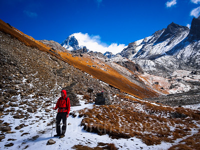
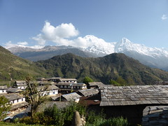
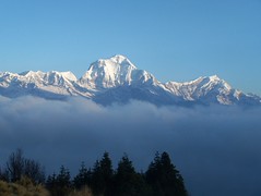
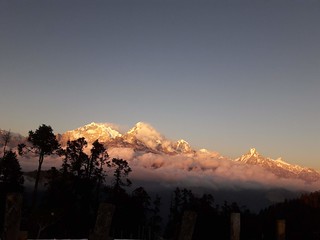
Annapurna-Dhaulagiri Hidden Ridge
Trek Highlights
- Panoramic Mountain Views: Witness breathtaking sunrises and sunsets over Annapurna and Dhaulagiri ranges from Mohare Danda and Khopra Ridge. Catch glimpses of Machhapuchhare and Annapurna South.
- Diverse Trekking Experience: Traverse through varied landscapes, from lush forests and terraced farmlands to high-altitude ridges and stunning viewpoints.
- Off-the-Beaten-Path Adventure: Explore less-traveled trails and experience a more peaceful and authentic trekking experience compared to busier routes.
- Cultural Immersion: Interact with local Magar and Gurung communities, stay in community lodges, and learn about their unique cultures and traditions.
- Rhododendron Forests: Trek through vibrant rhododendron forests (especially beautiful during blooming season).
- Khopra Ridge & Khayar Lake: Reach the stunning Khopra Ridge for panoramic mountain vistas and optionally hike to the sacred Khayar Lake (4,500m).
- Community-Based Tourism: Support local communities by staying in eco-lodges and teahouses along the trail.
- Moderate to Challenging Trek: Enjoy a fulfilling trek with a mix of moderate and challenging sections, suitable for trekkers with some experience.
- A Rewarding Himalayan Journey: Experience a blend of natural beauty, cultural richness, and a sense of adventure on this unforgettable trek.
Culture & Spiritual Heritage
- Galeshwor Mahadev Temple: A significant Hindu pilgrimage site uniquely constructed on a single massive rock, where devotees gather to worship Lord Shiva at the confluence of sacred waters.
- Sacred Khayar Lake: A high-altitude spiritual destination for both Hindus and Buddhists; the lake is believed to have purifying powers and serves as a major site for rituals and offerings.
- World Peace Pagoda: A striking Buddhist stupa in Pokhara that symbolizes the universal quest for peace and provides a serene space for meditation and reflection.
- Magar and Gurung Traditions: The trek showcases the rich heritage of the Magar and Gurung ethnic groups, famous for their hospitality, distinct stone-built architecture, and legendary history as Gurkha soldiers.
- Terraced Agriculture and Rural Life: The cultural landscape is defined by centuries-old terraced farming techniques and traditional mountain lifestyles that remain deeply connected to the seasons and the land.
- Community-Led Social Innovation: Heritage in this region includes modern social history, such as the pioneering wireless internet and sustainable paper-making projects in Nangi village.
- Eco-Social Governance: The unique community-run lodge system represents a cultural commitment to collective welfare, where tourism directly funds local schools and medical clinics.
- Mountain Animism: Beyond formal religion, there is a deep spiritual respect for the mountains themselves, which are viewed as the home of deities and protectors of the local communities.
What's Included
Airport Transfers
- Pickup and drop-off between the airport and your hotel.
- Private vehicle for comfort and convenience.
Accommodation
- Hotel stay before and after the trek.
- 3-5 star accomodation with breakfast.
Teahouse Accommodation During the Trek
- Comfortable teahouse/lodge stays along the trail.
- Twin-sharing basis in local mountain lodges.
Meals During the Trek
- Three meals per day (breakfast, lunch, dinner).
- A mix of local and simple international dishes such as dal bhat, noodles, soups, and tea.
Experienced Trekking Guide
- Licensed, English-speaking guide.
- Deep knowledge of the Mohare and Khopra region, culture, and trails.
- Assistance with safety, navigation, and acclimatization.
Permits and Entry Fees
- Annapurana conversation area permits.
- TIMS (Trekkers’ Information Management System) card
Ground Transportation
- Round-trip drive between pokhara, galeshwor, ghandruk and pokhara.
- Scenic mountain road journey.
First Aid and Safety Support
- Basic first aid kit carried by the guide.
- Ongoing health monitoring throughout the trek.
Government Taxes and Service Charges
- All applicable local taxes and service fees included.
What's not Included
International Flights
- Airfare to and from Kathmandu is not included
Nepal Visa Fees
- Visa cost upon arrival in Nepal (paid directly at the airport)
Travel Insurance
- Mandatory travel insurance covering high-altitude trekking and emergency evacuation
Personal Expenses
- Snacks, chocolates, and extra drinks
- Bottled water, soft drinks, alcohol
- Hot showers, Wi-Fi, and battery charging along the trail
Lunch & Dinner
- Meals (except breakfast) are usually not included
Tips for Guide and Porter
- Tipping is expected but not mandatory
- A common practice to show appreciation for their support
Personal Trekking Gear
- Items like trekking boots, down jacket, gloves, and thermal wear
These can be rented or purchased if needed
Extra Accommodation or Meals
- Additional nights due to early arrival, late departure, or itinerary changes
Emergency Rescue and Evacuation
- Helicopter rescue or medical evacuation (should be covered by your insurance)
Unforeseen Expenses
- Costs arising from delays due to weather, landslides, strikes, or personal reasons
Upgraded Services
- Luxury hotel upgrades
- Helicopter return options
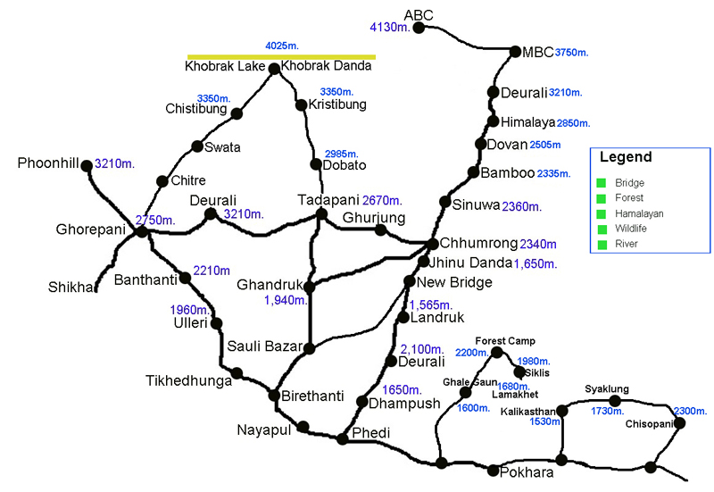
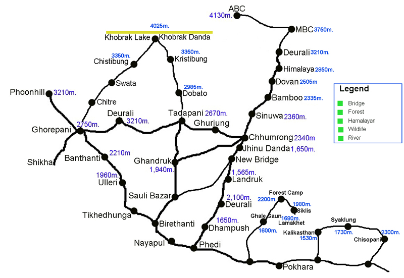
Tour Map
Frequently Asked Questions
The trek is considered moderate. While it doesn't reach the extreme altitudes of Everest Base Camp, it involves steady climbs and several days of 5–7 hours of walking. The most challenging part is the steep ascent to Khopra Ridge and the optional climb to Khayar Lake. Basic fitness and some hiking experience are recommended.
Yes, you need two main permits:
ACAP (Annapurna Conservation Area Permit): Required for entry into the protected region.
TIMS (Trekkers' Information Management System) Card: Required for hiker safety and tracking. Both can be obtained in Kathmandu or Pokhara.
At 3,300m (Mohare Danda) and 3,660m (Khopra Ridge), there is a risk of mild Acute Mountain Sickness (AMS). However, since your itinerary allows for gradual ascent, the risk is lower than on higher treks.
Spring (March to May): Famous for blooming rhododendron forests and clear mornings.
Autumn (September to November): Offers the most stable weather and the crispest views of the Annapurna and Dhaulagiri range
The route is famous for its community-run lodges and teahouses. These are generally basic but clean, offering twin-sharing rooms and communal dining areas. Staying here directly supports local schools and community projects.
yes, Many lodges in this region (especially in Nangi and Ghandruk) offer Wi-Fi for a small fee. You can charge your devices at the lodges, though they may charge 200–500 NPR for a full charge.
Layers: A good down jacket and fleece for cold nights.
Footwear: Slippers, trekking boots.
Water: A reusable bottle and purification tablets (avoiding plastic waste is a priority in these eco-sensitive areas).
Power Bank: Essential for when solar power is limited on cloudy days
Book This Trip
Contact Information
info@nepalcalling.com
nepalcalling4@gmail.com
Phone
+977-9860680553
+32-0485063791
977-9860680553
Related Trips
Let your travels tell a story—crafted by locals, inspired by mountains, and lived by you.
Join The Nepal Calling Newsletter
Be the first to receive exclusive Nepal tour packages, trekking offers, travel tips, destination guides, and seasonal travel inspiration—delivered straight to your inbox.